Adolph Heinrich Fiegenbaum
1793 — 1877
Land in St. Charles County, Missouri; 1840

Scale = 1:26,000
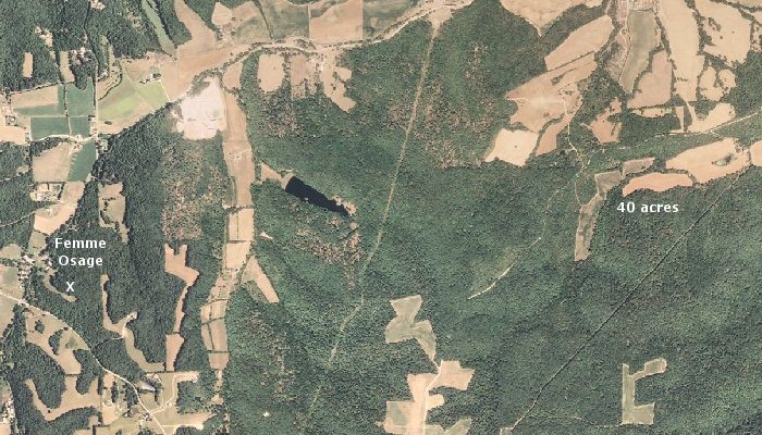
This map, based on aerial photographs taken in 2007, will give you some idea of the location of the 40 acres in St. Charles County, Missouri which Adolph Heinrich Fiegenbaum acquired through a federal land patent on 1 October 1840.
According to the patent, the property comprised the northwest quarter of the southeast quarter of Section 22 in Township 45 North, Range 1 East. The approximate location is labeled on this map.
The village of Femme Osage, Missouri is indicated on the left edge of the map. It lies just off State Highway T (seen cutting diagonally across the lower left corner of the map) and is about 2.5 miles (as the "crow flies") west Adolph's land.
The X near the clearing on the hill above the village indicates one of the cemeteries associated with the present-day Femme Osage United Church of Christ. There is another cemetery across the road in front of the church.