Adolph Heinrich Fiegenbaum
1793 — 1877
Land in Warren County, Missouri; 1844

Scale = 1:26,000
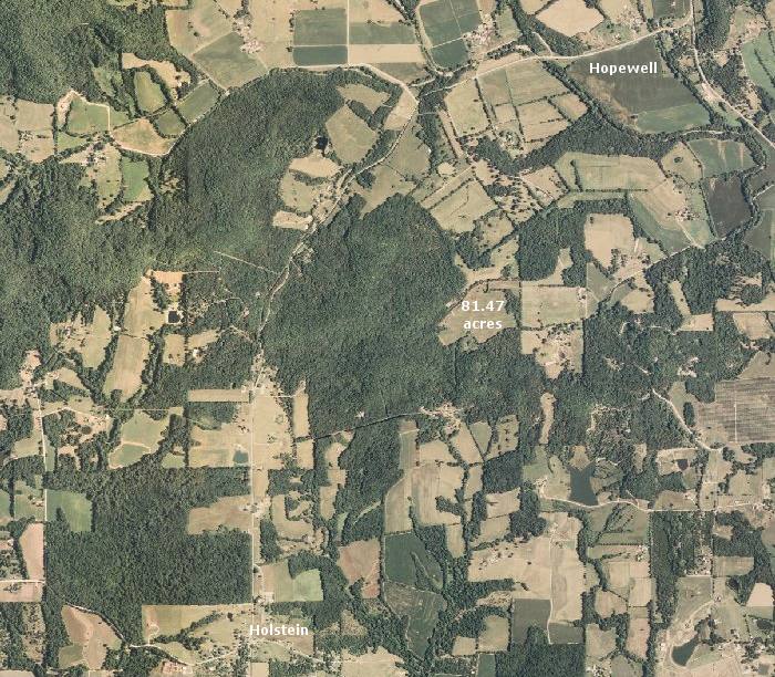
This map, based on aerial photographs taken in 2007, identifies an area of Warren County, Missouri associated with the Fiegenbaum family.
On 1 August 1844, "Adolphus Fiegenbaum," of Warren County, Missouri, acquired 81.47 acres of land here through a federal land patent. The property was described in the patent as "...the North East quarter of the South East quarter, and the East fractional half of the North East quarter of Section eight, in Township forty five, of Range two West...." The approximate location of the land is indicated on this map (the total acreage extended down into the wooded area below the label on the map).
A federal land patent dated 1 October 1840 shows that Adolph had been the owner of 40 acres in neighboring St. Charles County, Missouri.
In 1841, Adolph's elder brother, Johann Heinrich Fiegenbaum, and his extended family, numbering at least 13 people, had also immigrated to Missouri, and they are believe to have settled in this same general vicinity.
Adolph's land is about 1.4 miles (in a straight line) northeast of the village of Holstein, site of Immanuels United Church of Christ.